The 60-second version
The trails around Blue Mountain and Collingwood sit on the Blue Mountains section of the Bruce Trail, which runs roughly 66 km from Lavender to Craigleith along the Niagara Escarpment. The terrain ranges widely — from the genuinely easy, mostly level 5.5 km Loree Forest Loop to the sustained escarpment climbs of Pretty River Valley Provincial Park, where the Bruce Trail reaches its highest point at Nottawasaga Lookout. For Wasaga-based runners and hikers used to flat sand and rail-trail, this is the closest legitimate hill and technical-trail training. Parking is paid at Blue Mountain Resort’s village lots in peak season and at some Town of The Blue Mountains trailheads; access at Pretty River Valley (a non-operating provincial park) is free. Go in May, June, September, or October — midsummer heat on the exposed rock is punishing and shoulder-season conditions are dramatically better.
Educational journalism, not medical advice. Every claim here is checked against its cited sources by editor Timothy Bunce — a health writer, not a physician. It isn’t specific to your situation: for health decisions, talk to your own clinician. How we work →
Some links in this article are affiliate links. If you buy through one, The Beachside Reader earns a commission at no extra cost to you. It never changes which products we pick, or what we say about them. Full affiliate disclosure →
The trail system at a glance
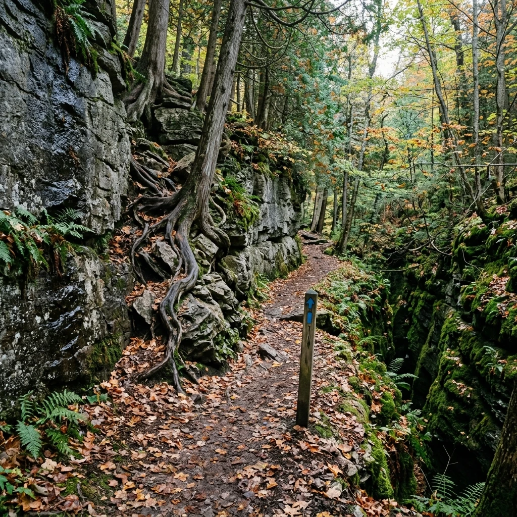
The Bruce Trail’s Blue Mountains section runs roughly 66 km from Lavender to Craigleith, tracing the Niagara Escarpment past the ski hills above Collingwood. Blue-blazed side trails branch off the white-blazed main line, and the surrounding area adds conservation-authority and volunteer-maintained networks. The section is maintained by the Blue Mountains Bruce Trail Club, whose maps and side-trail registry are the authoritative source for current routes Bruce Trail Conservancy 2024.
Four verified routes are the most useful starting points:
- Loree Forest Loop (5.5 km) — the 2.1 km Len Gertler Side Trail plus the main Bruce Trail form a mostly level loop through hardwood bush and conifer plantation in the Len Gertler Memorial Loree Forest, with a lookout over Georgian Bay. Reached by a 600 m access path from roadside parking on 21st Sideroad. The genuinely runnable introduction to the area.
- Pretty River and Bruce Trail loop (about 11 km) — the moderately challenging loop through Pretty River Valley Provincial Park, climbing to Nottawasaga Lookout, the highest point on the Bruce Trail. Roughly 350 m of cumulative ascent; hikers typically allow about 4 hours. The real hill-training venue in the area.
- Keyhole Side Trail at Nottawasaga Bluffs Conservation Area (740 m) — a short side trail near Singhampton that squeezes through a crevice in the limestone bluffs; snow lingers in the crevices into June. Combined with the Lookout Side Trail and the main Bruce Trail it makes a loop of roughly 5 km.
- Kolapore Uplands (roughly 50 km network) — a volunteer-maintained wilderness network about 20 km southwest of Collingwood, run by the Kolapore Wilderness Trails Association: hiking and mountain biking in summer, ungroomed wilderness ski trails in winter. The most adventurous terrain in the area.
What makes this harder than the Wasaga local trails
Three terrain features distinguish Blue Mountain from anything in the immediate Wasaga area:
Sustained gradient. The climbs in Pretty River Valley Provincial Park are the standout — the loop over Nottawasaga Lookout stacks roughly 350 m of cumulative ascent. There is no Wasaga-area equivalent. Local runners use the Pretty River climbs as their hill-training surface because nothing closer comes near it.
Exposed limestone. Sections of the main Bruce Trail and several side trails cross flat limestone “pavement” that’s slippery when wet, blistering hot in summer sun, and treacherous in early-spring or late-fall freeze-thaw conditions. Trail-running shoes with sticky rubber outsoles (Vibram Megagrip or equivalent) handle this dramatically better than standard daily trainers.
Technical descents. The descents off the escarpment rim in Pretty River Valley have loose-rock sections and step-down rock features that demand running form most flat-trail runners haven’t developed. Technical descents place substantially higher eccentric load on the quadriceps and ankle stabilisers than flat-pace running — which is why the Blue Mountain network produces serious DOMS in runners on first exposure.
Preparation: don’t come straight from the Wasaga flats
The most reliable predictor of a bad first day on Blue Mountain is jumping straight from flat Wasaga running to the Pretty River Valley climbs. The terrain demands ankle stability, eccentric quad strength, and trail-specific footwear that flat-running practice doesn’t develop.
The right preparation arc is 6-8 weeks of progressive trail volume on the Wasaga local options before attempting Blue Mountain. Specifically:
- Weeks 1-2: 2-3 sessions per week on the Blueberry Trail for surface variety.
- Weeks 3-4: Add the Ganaraska Wasaga section Pine Bush ridge climb for sustained-gradient exposure.
- Weeks 5-6: Add stair repeats or a treadmill incline session weekly to load the eccentric quad work.
- Weeks 7-8: Start with the mostly level Loree Forest Loop as the terrain introduction, then attempt the Pretty River Valley loop. Walk the steep sections; don’t try to run them on day one.
This progression takes the chronic-injury rate down meaningfully. Skipping it produces ankle sprains, IT band flare-ups, and post-run soreness that pushes runners away from the terrain entirely.
Weather considerations specific to the Escarpment
Blue Mountain sits roughly 250 m higher than Wasaga Beach and gets meaningfully different weather. Summer afternoon thunderstorms develop quickly over the Escarpment ridge; the exposed limestone sections are dangerous in lightning. Check the Environment Canada radar before driving up; if storm cells are approaching, postpone.
Winter ice forms on the limestone ridge sections through November and persists into mid-April. Microspikes or full crampons are needed for sustained winter use; standard trail-running shoes are not adequate. Most local runners shift to the Wasaga Nordic Centre or Ganaraska section in December-March and return to Blue Mountain in late April.
Mid-July through August humidity is the rough month for the rock sections — the dark limestone heats up and radiates significantly above ambient air temperature. Early morning runs (before 8 am) are dramatically more pleasant than mid-day in summer.
Practicalities
- Parking: Blue Mountain Resort village lots are paid in peak periods, and the Town of The Blue Mountains charges non-residents for parking at popular trailheads in season — check current rates before you go. Pretty River Valley Provincial Park is a non-operating park with no gate or fees. Loree Forest uses roadside parking on 21st Sideroad; Nottawasaga Bluffs Conservation Area has its own lot.
- Water: none on trail. Carry vest reservoir for runs over 8 km.
- Cell coverage: spotty in the ravines and on wooded stretches of the escarpment. Download offline maps before you go.
- Bears: active April-November. Bear bells and noise on blind corners are sensible.
- Bruce Trail membership: not required for day use of the public trail, but membership fees fund trail maintenance Bruce Trail Conservancy 2024 (see brucetrail.org for current rates). Worth the contribution if you use the system regularly.
Where it fits vs the Wasaga local rotation
Blue Mountain is the “step up” venue. Most local runners use it for one weekly long run or hill session, with the rest of their weekly volume on the flatter Wasaga options. A typical pattern: Sunday long run on Blue Mountain (90-120 minutes), Tuesday-Wednesday-Friday recovery and tempo on the Nordic Centre, Saturday medium-effort on the Ganaraska Wasaga section. That mix produces the best return on driving time and training stimulus across the local-plus-Blue-Mountain options.
For runners not yet ready for Blue Mountain, the Wasaga local rotation alone is sufficient for general fitness; the Escarpment terrain only becomes necessary when you’re training for a specific hilly race or want the technical-descent skill development. Don’t feel obligated to drive south just because the option exists.
Practical takeaways
- Roughly 66 km of main Bruce Trail in the Blue Mountains section (Lavender to Craigleith), plus blue-blazed side trails and the ~50 km Kolapore network. Four verified routes from a mostly level 5.5 km loop to wilderness single-track.
- Sustained gradient + exposed limestone + technical descents. The three features that distinguish Blue Mountain from anything closer to Wasaga.
- Don’t arrive flat-trained. 6-8 weeks of progressive trail volume on Wasaga local options first.
- Trail-specific shoes mandatory. Sticky rubber outsole (Vibram Megagrip or equivalent) makes the limestone manageable.
- One Blue Mountain session per week is the sweet spot for most runners. The rest of the volume on the local Wasaga rotation.
Frequently asked questions
Can I run Blue Mountain in winter?
Sustained running, no — the limestone ridge sections ice over by mid-November. Microspikes or full crampons are needed; even with traction the technical descents become high-risk. Most local runners shift to the Wasaga Nordic Centre or Ganaraska section December-March and return to Blue Mountain in late April.
How does it compare to the Bruce Peninsula trail running?
The Bruce Peninsula (3-4 hour drive north) has more dramatic terrain — exposed cliffs, longer sustained climbs, more wilderness. Blue Mountain is the closest legitimate Escarpment training accessible from Wasaga in a same-day visit.
Do I have to pay for parking?
At Blue Mountain Resort’s village lots, yes, in peak periods — and the Town of The Blue Mountains charges non-residents for parking at popular trailheads in season; check current rates before you go. Pretty River Valley Provincial Park is a non-operating park with no entry gate or fees, and Loree Forest is reached from roadside parking on 21st Sideroad.
Can I bring my mountain bike?
Yes on designated mountain-biking sections — the Kolapore Uplands network (roughly 50 km, maintained by the Kolapore Wilderness Trails Association) is the local hub. The hiking-only Bruce Trail and most of the side trails are foot-traffic only; check the trailhead signage.
Are the trails dog-friendly?
On-leash, yes, on most trails. Ontario Parks requires dogs to be leashed at all times in Pretty River Valley, and Bruce Trail Conservancy policy is on-leash throughout the trail system; respect this for wildlife and bear-encounter reasons.
References
Bruce Trail ConservancyBruce Trail Conservancy. Trail standards, side-trail registry, and Blue Mountain segment management. View source →